Menu

Blog

Archive for the ‘mapping’ category: Page 5

Jul 29, 2024

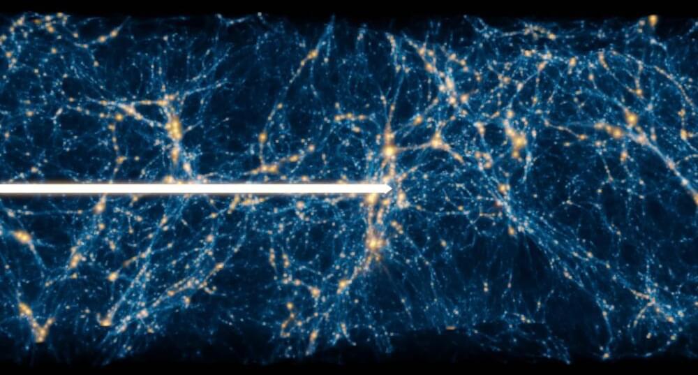
Dark matter seen through forest: Study examines matter distribution and supports unknown influence or new particle

Posted by in categories: cosmology, mapping, particle physics

The dense peaks in the wavelength distribution graph observed in a Lyman-Alpha forest indeed resemble many small trees. Each of those peaks represents a sudden drop in “light” at a specific and narrow wavelength, effectively mapping the matter that light has encountered on its journey to us.

Jul 29, 2024

Mapping the Mechanisms of Aging

Posted by in categories: biological, genetics, life extension, mapping, neuroscience

Aging is a universal experience, evident through changes like wrinkles and graying hair. However, aging goes beyond the surface; it begins within our cells. Over time, our cells gradually lose their ability to perform essential functions, leading to a decline that affects every part of our bodies, from our cognitive abilities to our immune health.

To understand how cellular changes lead to age-related disorders, Calico scientists are using advanced RNA sequencing to map molecular changes in individual cells over time in the roundworm, C. elegans. Much like mapping networks of roads and landscapes, we’re charting the complexities of our biology. These atlases uncover cell characteristics, functions, and interactions, providing deeper insights into how our bodies age.

In the early 1990s, Cynthia Kenyon, Vice President of Aging Research at Calico, and her former team at UCSF discovered genes in C. elegans that control lifespan; these genes, which influence IGF1 signaling, function similarly to extend lifespan in many other organisms, including mammals. The genetic similarities between this tiny worm and more complex animals make it a useful model for studying the aging process. In work published in Cell Reports last year, our researchers created a detailed map of gene activity in every cell of the body of C. elegans throughout its development, providing a comprehensive blueprint of its cellular diversity and functions. They found that aging is an organized process, not merely random deterioration. Each cell type follows its own aging path, with many activating cell-specific protective gene expression pathways, and with some cell types aging faster than others. Even within the same cell type, the rate of aging can vary.
Jul 29, 2024

How AI is fixing traffic lights | Project Green Light

Posted by in categories: mapping, robotics/AI, transportation

We’re using AI and Google Maps driving trends to optimize traffic light patterns and improve traffic flow. Stop-and-go traffic in urban areas causes 29 times more emissions than on open roads. Researchers at Google are partnering with cities around the globe, from Rio to Jakarta. So far, local governments have saved fuel and lowered emissions for nearly 30 million car rides every month. Learn more about this research at: https://g.co/research/greenlight.

If you are a city representative or traffic engineer and are interested in joining the waiting list, please complete this form: https://docs.google.com/forms/d/e/1FA

Continue reading “How AI is fixing traffic lights | Project Green Light” »

Jul 25, 2024

Network properties determine neural network performance

Posted by in categories: information science, mapping, mathematics, mobile phones, robotics/AI, transportation

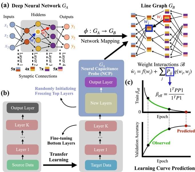
Machine learning influences numerous aspects of modern society, empowers new technologies, from Alphago to ChatGPT, and increasingly materializes in consumer products such as smartphones and self-driving cars. Despite the vital role and broad applications of artificial neural networks, we lack systematic approaches, such as network science, to understand their underlying mechanism. The difficulty is rooted in many possible model configurations, each with different hyper-parameters and weighted architectures determined by noisy data. We bridge the gap by developing a mathematical framework that maps the neural network’s performance to the network characters of the line graph governed by the edge dynamics of stochastic gradient descent differential equations. This framework enables us to derive a neural capacitance metric to universally capture a model’s generalization capability on a downstream task and predict model performance using only early training results. The numerical results on 17 pre-trained ImageNet models across five benchmark datasets and one NAS benchmark indicate that our neural capacitance metric is a powerful indicator for model selection based only on early training results and is more efficient than state-of-the-art methods.

Jul 24, 2024

Automated construction of cognitive maps with visual predictive coding

Posted by in categories: mapping, robotics/AI, space

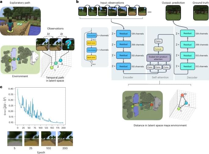
Constructing spatial maps from sensory inputs is challenging in both neuroscience and artificial intelligence. Gornet and Thomson show that as an agent navigates an environment, a self-attention neural network using predictive coding can recover the environment’s map in its latent space.

Jul 18, 2024

Space mission that maps forests in 3D makes an early comeback

Posted by in categories: mapping, robotics/AI, space

Call it the force’s doing, but it has been surprises galore for the GEDI mission.

In early 2023, the lidar mission that maps the Earth’s forests in 3D was to be burned up in the atmosphere to make way for another unrelated mission on the International Space Station. A last-minute decision by NASA saved its life and put it on hiatus until October 2024. Earlier this year, another surprise revealed itself: the mission that replaced GEDI was done with its work, effectively allowing GEDI to get back to work six months earlier than expected.

That’s how, in April, a robotic arm ended up moving the GEDI mission (short for Global Ecosystem Dynamics Investigation and pronounced “Jedi” like in the Star Wars films) from storage on the ISS to its original location, from where it now continues to gather crucial data on aboveground biomass on Earth.

Jul 10, 2024

Mapping the surfaces of MXenes, atom by atom, reveals new potential for the 2D materials

Posted by in categories: chemistry, mapping, particle physics, sustainability

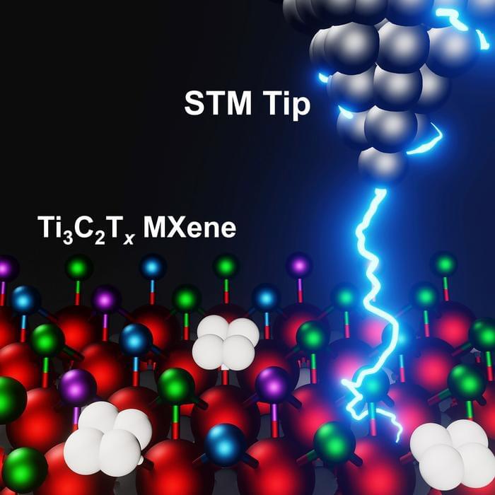
In the decade since their discovery at Drexel University, the family of two-dimensional materials called MXenes has shown a great deal of promise for applications ranging from water desalination and energy storage to electromagnetic shielding and telecommunications, among others. While researchers have long speculated about the genesis of their versatility, a recent study led by Drexel and the University of California, Los Angeles, has provided the first clear look at the surface chemical structure foundational to MXenes’ capabilities.

Using advanced imaging techniques, known as scanning tunneling microscopy (STM) and scanning tunneling spectroscopy (STS), the team, which also includes researchers from California State University Northridge, and Lawrence Berkeley National Laboratory, mapped the electrochemical surface topography of the titanium carbide MXene — the most-studied and widely used member of the family.

Their findings, published in the 5th anniversary issue of the Cell Press journal Matter (“Atomic-scale investigations of Ti 3 C 2 Tx MXene surfaces”), will help to explain the range of properties exhibited by members of the MXene family and allow researchers to tailor new materials for specific applications.

Jul 10, 2024

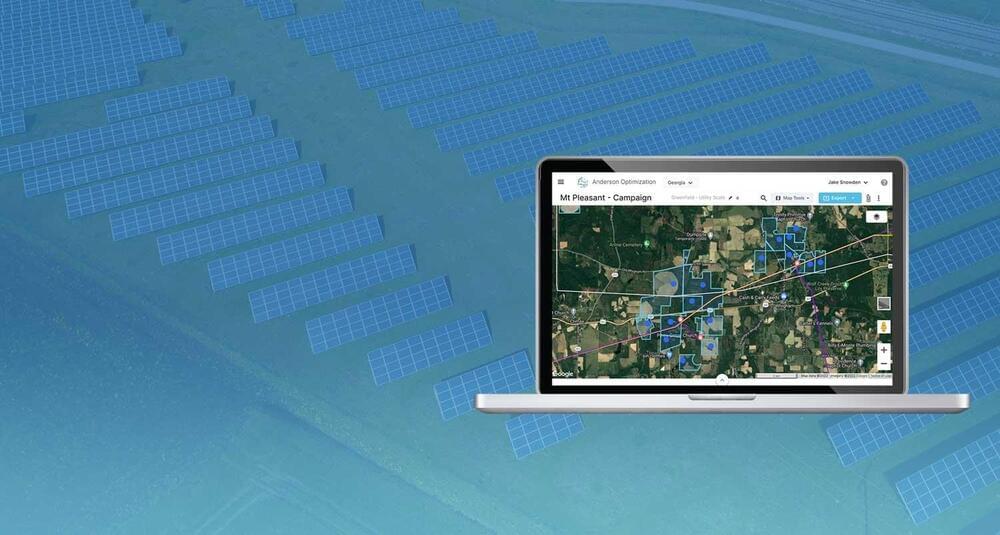
AO: AO GIS Site Selection Software makes renewable energy farm development simple with capacity and land data paired with an intuitive mapping platform

Posted by in categories: energy, food, mapping, sustainability

GIS Site Selection Software makes renewable energy farm development simple with capacity and land data paired with an intuitive mapping platform.

Jul 6, 2024

Deformation Imaging: Revolutionizing Our View of Earth’s Subterranean Mysteries

Posted by in categories: computing, mapping

A new computational technique developed enables the use of surface mapping technologies like GPS to analyze subsurface geological structures.

This method, termed deformation imaging, offers insights into the rigidity of the Earth’s crust and mantle, enhancing our understanding of geological processes like earthquakes. The technique has already provided a detailed view of subsurface areas during the 2011 Tohoku earthquake and has the potential for widespread future applications with satellite data.

New Geological Imaging Technique

Jul 2, 2024

MMGIS: Open-Source Mapping Interface for Mars Exploration

Posted by in categories: mapping, space

“Every mission is contributing back to the other missions and future missions in terms of new tools and techniques to develop,” said Dr. Fred Calef III. “It’s not just you working on something. It’s being able to share data between people… getting a higher order of science.”


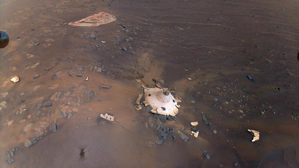
As NASA’s Perseverance rover continues to explore the surface of Mars, an open-source, online mapping software known as Multi-Mission Geographic Information System (MMGIS) has been instrumental in determining the best routes for the car-sized rover and landing sites for its Ingenuity helicopter prior to the latter’s “retirement” but is also available for the public to follow the mission, as well. This software holds the potential to help both scientists and the public explore Mars in new and exciting ways for years to come.

“Maps and images are a common language between different people — scientists, engineers, and management,” said Dr. Nathan Williams, who is a mapping specialist at NASA JPL and was a key player in selecting Jezero Crater as the landing site for the Perseverance rover. “They help make sure everyone’s on the same page moving forward, in a united front to achieve the best science that we can.”

Continue reading “MMGIS: Open-Source Mapping Interface for Mars Exploration” »

Page 5 of 55First23456789Last