Menu

Blog

Archive for the ‘mapping’ category: Page 31

Jun 6, 2022

Using mirrors, lasers and lenses to bend light into a vortex ring

Posted by in categories: information science, mapping, mathematics

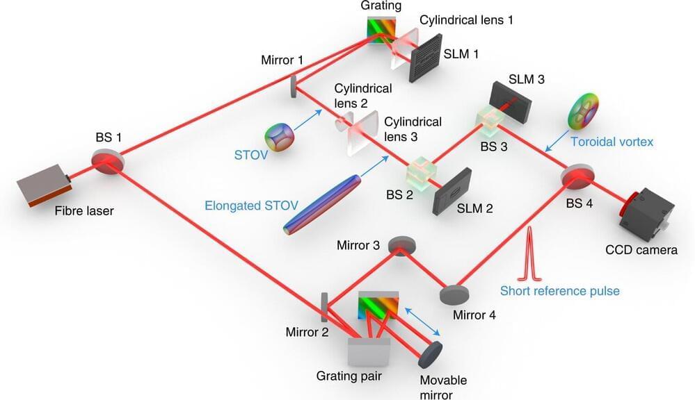
A team of researchers from the University of Shanghai for Science and Technology and the University of Dayton has developed a way to bend light into a vortex ring using mirrors, lasers and lenses. In their study, published in the journal Nature Photonics, the group built on work done by other teams in which vortex rings were observed incidentally, and then mathematically designed a system that could generate them on demand.

In 2016, another team of researchers discovered that under the right circumstances, strong pulses of light swirling around a central pipe-shaped pulse, could sometimes form into a donut-shaped vortex. Intrigued by the finding, the researchers with this new effort began to wonder if it might be possible to create such on demand.

They started by studying the properties and conditions that had led to the formations observed by the team in 2016 and applied mathematics to the problem. They found solutions that appeared to show how such rings could be made—solutions to Maxwell’s equations, in particular, they found, could be used to generate the kind of conformal mapping required.
Jun 3, 2022

A New Signature of a Multiply Connected Universe

Posted by in categories: cosmology, mapping

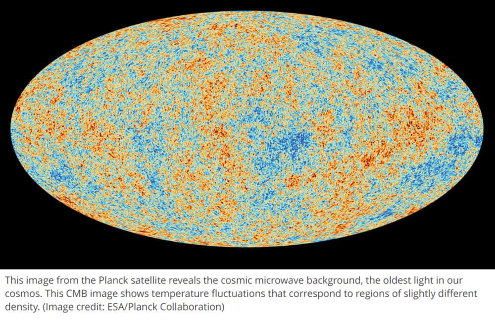
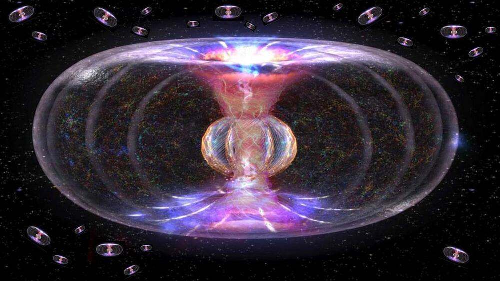
Scientists have measured an upper-bound to the size of the Universe using the Cosmic Microwave Background (CMB) temperature gradient field [1]. The results show that the universe is most likely multiply connected, which means that it is finite, and the topology is such that it closes back in on itself—such that on the largest scale the universe has the geometry of a torus (and has a global positive curvature). This is contrary to the conventional cosmological models of the universe that model it as spatially infinite and topologically flat—assumed parameters that the researchers of the latest study demonstrate do not match the CMB temperature gradient data.


If the universe were spatially infinite and topologically flat, then the temperature fluctuations seen in the CMB would occur across all size scales—however this is not what is observed in the data. If, instead, the universe has a finite size and a multiply connected topology, like that of a torus, then in the early universe when the CMB was first emitted temperature fluctuations would be restricted in size since they could not be larger than the universe at that time. This would be observable in the extant CMB temperature gradient as a specific wave-length cut-off, which has now been described and demonstrated in a comprehensive analysis of the observed Planck CMB maps.

One of the researchers on the team that performed the study— astrophysicist Thomas Buchert, of the University of Lyon, Astrophysical Research Center in France— told Live Science in an email “We could say: Now we know the size of the universe” [2]. As reported by Live Science, Buchert further explained “In an infinite space, the perturbations in the temperature of the CMB radiation exist on all scales. If, however, space is finite, then there are those wavelengths missing that are larger than the size of the space.”

May 31, 2022

UW-developed, cloud-based astrodynamics platform to discover and track asteroids

Posted by in categories: information science, mapping, space

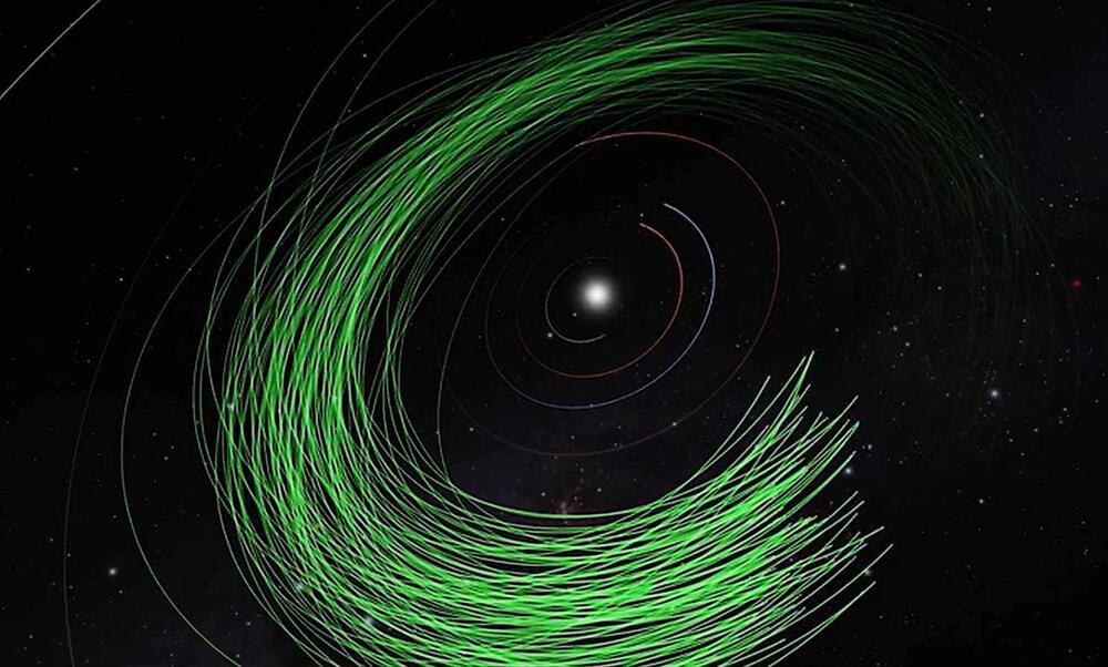
A novel algorithm developed by University of Washington researchers to discover asteroids in the solar system has proved its mettle. The first candidate asteroids identified by the algorithm — known as Tracklet-less Heliocentric Orbit Recovery, or THOR — have been confirmed by the International Astronomical Union’s Minor Planet Center.

The Asteroid Institute, a program of B612 Foundation, has been running THOR on its cloud-based astrodynamics platform — Asteroid Discovery Analysis and Mapping, or ADAM — to identify and track asteroids. With confirmation of these new asteroids by the Minor Planet Center and their addition to its registry, researchers using the Asteroid Institute’s resources can submit thousands of additional new discoveries.

Continue reading “UW-developed, cloud-based astrodynamics platform to discover and track asteroids” »

May 31, 2022

Astronomers demonstrate how using the cloud can rev up the rate of discovery for asteroids

Posted by in categories: information science, mapping, space

Astronomers have used a cloud-based technique pioneered at the University of Washington to identify and track asteroids in bunches of a hundred or more. Their achievement could dramatically accelerate the quest to find potentially threatening space rocks.

The technique makes use of a cloud-based, open-source analysis platform known as Asteroid Discovery Analysis and Mapping, or ADAM; plus a recently developed algorithm called Tracklet-less Heliocentric Orbit Recovery, or THOR. The THOR algorithm was created by Joachim Moeyens, an Asteroid Institute Fellow at UW; and Mario Juric, director of UW’s DiRAC Institute.

Continue reading “Astronomers demonstrate how using the cloud can rev up the rate of discovery for asteroids” »

May 30, 2022

Hubble captures a perfectly formed Grand Design Spiral

Posted by in categories: mapping, space

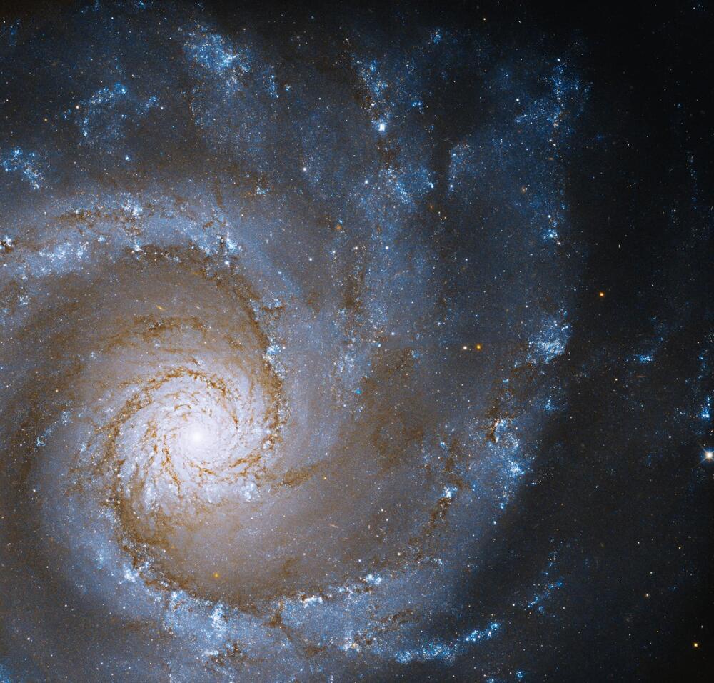
An image captured by the Hubble Space Telescope and shared by NASA this week shows the most stunning of spiral galaxies: A Grand Design Spiral called NGC 3,631, given that designation because of its clear, prominent arms and highly organized spiral structure. This ideal spiral galaxy is located 53 million light-years from Earth in the constellation of Ursa Major and is seen face-on from Earth to give a perfect view of its pleasing structure.

The image was created using data from two of Hubble’s instruments, the Wide Field Camera 3 and Advanced Camera for Surveys. The Advanced Camera for Surveys is a Hubble camera used primarily for capturing data in the visible light range, which is the same range seen by the human eye. It was installed onto Hubble in 2002. The Wide Field Camera 3 is a newer instrument, installed in 2009 as an upgrade to the older Wide Field and Planetary Camera 2. The Wide Field Camera 3 is used to capture ultraviolet and infrared light as well as to detect visible light.

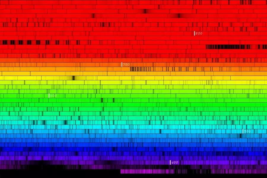
This image combines both visible light and infrared data. The blue shades represent light which is in the blue visible light wavelength, while the orange represents the infrared data. Looking in the infrared is helpful to look through clouds of dust that are opaque in visible light, and it also maps out the distribution of heat as warm material gives off infrared light.

May 26, 2022

New calculations of solar spectrum resolve decade-long controversy about the sun’s chemical composition

Posted by in categories: chemistry, cosmology, mapping, physics

What do you do when a tried-and-true method for determining the sun’s chemical composition appears to be at odds with an innovative, precise technique for mapping the sun’s inner structure? That was the situation facing astronomers studying the sun—until new calculations that have now been published by Ekaterina Magg, Maria Bergemann and colleagues, and that resolve the apparent contradiction.

The decade-long solar abundance crisis is the conflict between the internal structure of the sun as determined from solar oscillations (helioseismology) and the structure derived from the fundamental theory of stellar evolution, which in turn relies on measurements of the present-day sun’s . The new calculations of the physics of the sun’s atmosphere yield updated results for abundances of different chemical elements, which resolve the conflict. Notably, the sun contains more oxygen, silicon and neon than previously thought. The methods employed also promise considerably more accurate estimates of the chemical compositions of stars in general.

May 25, 2022

Quantum physics offers insights about leadership in the 21st century

Posted by in categories: mapping, neuroscience, quantum physics

According to complexity economist Brian Arthur and physicist Geoffrey West human social systems function optimally as complex adaptive systems – or quantum systems.

The newly developed field of quantum leadership maps the human, conscious equivalents onto the 12 systems that define complex adaptive systems or quantum organisations. These are: self-awareness; vision and value led; spontaneity; holism; field-independence; humility; ability to reframe; asking fundamental questions; celebration of diversity; positive use of adversity; compassion; a sense of vocation (purpose).

Quantum leadership is essentially a new management approach that integrates the most effective attributes of traditional leadership with recent advances in both quantum physics and neuroscience. It is a model that allows for greater responsiveness. It draws on our innate ability to recognise, adapt and respond to uncertainty and complexity.

May 19, 2022

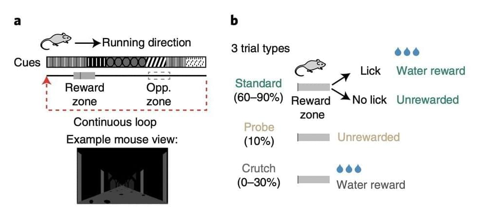
Study shows that behavioral engagement could affect hippocampal place codes

Posted by in categories: mapping, neuroscience

The hippocampus is a region of the brain known to the associated with memory, learning, spatial navigation and emotion. In 1971, neuroscientists discovered that the hippocampus influences spatial navigation through the formation of a series of “spatial codes,” which encode characteristics related to an animal or human’s surrounding environment, including sensory cues and where rewards are located.

These codes are encoded by a type of neurons known as “place cells,” which were found to become active when an animal is entering a specific place or location in its . Together, place cells in the hippocampus form representations of the places that animals are navigating, also known as cognitive maps.

Since place cells were first uncovered, numerous teams worldwide have been conducting studies aimed at better understanding their function and how they encode spatial information. While there is now a large body of research focusing on place cells, some of the factors influencing their functioning are still poorly understood.

May 17, 2022

Google Maps to add ‘immersive view’

Posted by in categories: mapping, satellites

Google Maps to add “immersive view”

Google Maps, the world’s most-downloaded travel app, will soon become more immersive and intuitive thanks to a major upgrade.

The online tool is used by over 1 billion people every month. It already includes satellite imagery, aerial photography, street maps, 360° interactive panoramic views of streets, real-time traffic conditions, and route planning. At its annual I/O developer conference held in California, Google announced key features being added to further enhance its appearance and functionality.

May 16, 2022

Google’s ‘Immersive View’ Could Revolutionize Maps

Posted by in category: mapping

Google’s new Immersive View is a leap forward for how data is displayed in Google Maps.

Page 31 of 53First2829303132333435Last